Drones (UAVs)
Our drones and proprietary analysis software enable us to produce high-resolution aerial photographs.
Drone/UAV System
Our drone/UAV system is a cost-effective and readily available technology that we use in the following areas:
- Construction progress documentation
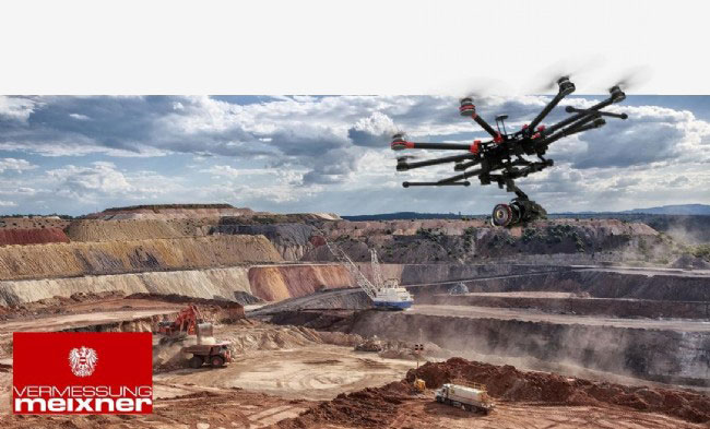
- Surveying quarries, gravel pits, and landfills
- Monitoring environmental activities
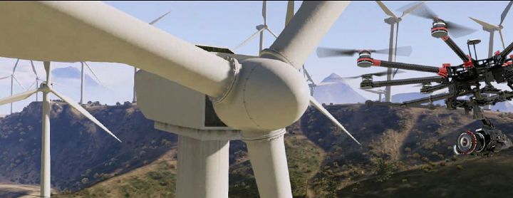
- Monitoring and inspection of wind turbines and industrial plants
- Surveying and photogrammetry
- Architectural photography
- Real estate marketing
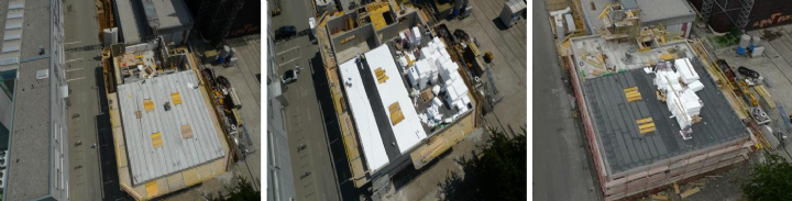
Construction progress documentation
Construction work is monitored and objectively documented with our drones, minimizing effort. The current status of construction progress is recorded chronologically from all perspectives.
A typical application is construction monitoring in building construction and road construction. We rely on regular aerial surveys to monitor construction projects.
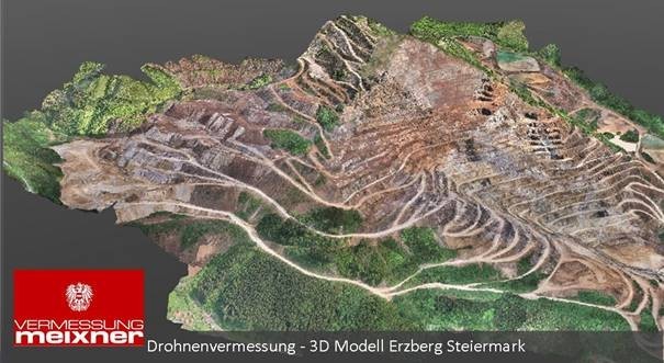
Surveying Quarries, Gravel Pits, and Landfills
Our drones are capable of generating highly accurate 3D models, terrain models, and orthophotos in a very short time without disrupting ongoing operations. Using drones, we can quickly and precisely conduct measurements, even in difficult terrain (quarries, gravel pits, construction sites, landfills), without interrupting operations.
The following services are available in this area:
- 3D models, terrain models, orthophotos
- Calculation of volumes, extraction volumes, target/actual comparisons
- Monitoring of slope movements
- Contour lines and profiles, line analysis
- Open-pit mine maps
Monitoring
Our highly specialized drones are ideally suited for fast and safe inspections of hard-to-reach or large-scale objects and industrial facilities. High-resolution cameras and close-range imaging provide a detailed view of potential damage.
Our services enable significantly more efficient and timely monitoring and inspection of industrial plants, dams, and pipeline networks than conventional methods.
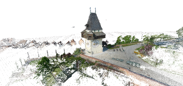
Surveying and Photogrammetry
Our drones are ideally suited for complex tasks where high visual quality and surveying precision are paramount.
We achieve accuracies of +/-1 cm in subsequent 3D modeling. Our drone system has proven its worth in documenting historical structures such as the Graz Clock Tower and Eggenbarg Castle, as well as determining the volume of landfills.
Applications.
- Surveying of hard-to-reach objects (landfills, pits, spoil heaps, quarries, slopes, open-pit mining areas)
- 3D volume calculations
- Documentation (environmental events, historic preservation)
- 3D modeling and visualization
- Digital terrain models
- Creation of topographic surveys, site plans, and as-built drawings
- Orthophotos
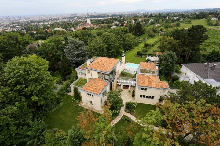
Architectural photography and real estate marketing
The highly detailed aerial capture and visualization of real estate is a perfect complement to surveying and an excellent tool for presenting properties attractively and up-to-date to a large customer base.
Is it economically feasible for industrial companies, construction firms, architects, real estate companies, or housing associations to photographically capture any property, its architectural features, the location of a building, or details of a facade with photographic precision and realism?
Aerial images from drones offer new perspectives in the field of architecture that would be very difficult or even impossible to create without this technology. These images reveal details even in otherwise difficult-to-access areas and provide representations of high-priced properties embedded in spectacular landscape shots.
In the preliminary stages of architectural and urban planning projects, photorealistic 3D renderings of the project plans and their surrounding environment are often necessary.
We support you in this process, from the initial surveying using multicopters or ground-based methods to the sophisticated creation of digital and virtual 3D models of your plans.